About the Boston 3D City Model
What's New?
In July 2021 the BPDA is rolling out several improvements to its framework for sharing its city model. These improvements will make it easier for architecture and engineering firms, neighboring municipalities and campuses to use the elements of BPDA's model in their own city modeling projects and to share updates back and forth with the BPDA. The new model framework is designed to preserve information about terrain, buildings and ground-plan as the city changes. These capabilities will support long-term archiving, open-source community applications including collaborative research on the history of places in Boston.
Enhanced Archival and Open-Source Sharing Strategy
- Persistent model identifiers and published catalog information facilitates synchronization between independent projects that use and improve the BPDA's building model collection.
- The 3D model collection is now shared in the open-standard .obj format with a city-wide model catalog in GeoJSON or CSV format. Makes model releases compatible with a variety of open-source tools for archival preservation, virtual reality and web visualization.
- The 3D Data Downloads page now allows users to download individual building models for those who only need to download updates.
- We have published a new Model Submission Guideline that will make it easy for designers and other 3D modelers to share their new and improved models with the metropolitan city modeling community.
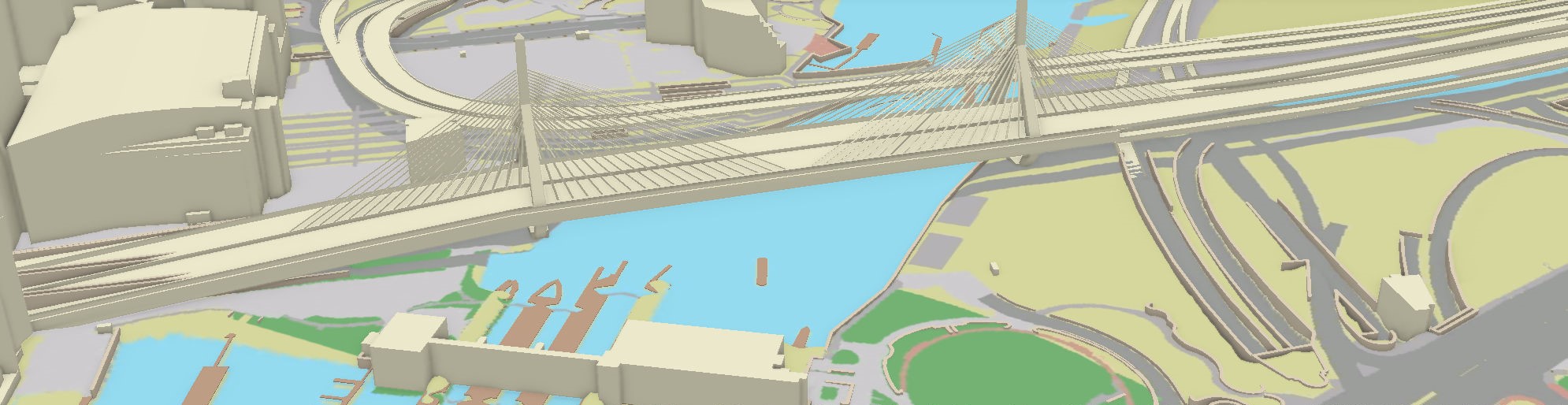
Improved Terrain, Bridges, Walls and Docks
- The detailed tiled terrain models now extend beyond the Boston city limits (thanks to MassGIS).
- Dozens of beautifully detailed bridge models have been added to the model collection by the BPDA Urban Design Technology Group.
- 3D models of walls have been added to the model collection. Walls make the hard-scape much more crisp!
- We have added a new true ortho photo base map captured in March 2021.
New Tile Grid and Coordinate System
- Based on the Massachusetts State Plane Coordinate System.
- Makes it easy to exchange data with engineers,surveyors and public agencies.
- Is designed to be extended to neighboring municipalities and campus models.
- A standard offset will make it much easier for 3d model collaborators to incorporate updates with the BPDA and to share models with each-other.
Learn More, Get Involved!
To read detailed documentation for each city model component and our strategy for easy model exchange, check out the Index to Documentation.
We hope that folks who are interested in using the BPDA's 3D model will find it easy to discover and download city model assets and complete tiled models that wil be compatible with their tools -- including automated access and transformation of our models for use in web visualizations, virtual reality apps and gaming.
Our new repository/catalog is designed to be adapted by our collaborators in neighboring municipalities and campuses, the design development community and academic projects to organize and share their own city model project that may overlap with the city of Boston. Visit our GitHub repository to understand how it works and to download a complete working demonstration.
Soon the BPDA GIS department will be organizing a webinar to introduce this framework and learn more about how to engage with all of our neighbors who are interested in using, improving and extending our city model.
For more information on how this project links up with other municipal and historical applications around the Boston Metro area, visit the project home page of our consultant pbcGIS.com